Landscapes
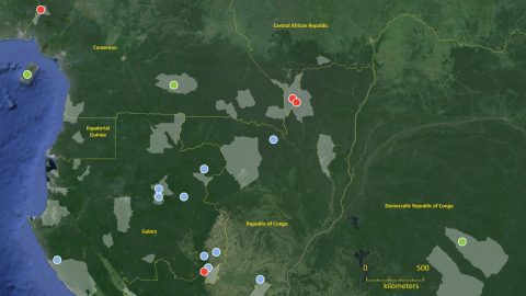
The biodiversity of Central Africa is harbored within vast expanses of forest—forests crossed, in most areas, only by elephant paths. In some seasons these forests can be nearly inaccessible even on foot. The 50-unit acoustic grid in northern Congo, pictured in the image above along with elephant call density and gunshot detections, monitors 1,250 sq km of forest. Each of our two teams walks this forest for nearly a month in order to visit each site, collect data, and refresh the power supply. But monitoring ever bigger expanses of forest is desperately needed.
The importance of monitoring at the scale of landscapes is clear from the example of elephant activity and gunshots shown above. Never before have we been able to map how elephants are shifting their use of the landscape over timescales of a few months. Even more vital, we can now quantify where the poaching is happening and try to adjust anti-poaching patrols and interdiction events accordingly.
Acoustic approaches are well suited to monitoring at landscape scales. This is because one can record, simultaneously, the activities of many species, weather events, as well as the presence of human activity. We can gather these data continuously, or schedule recording sessions, and data can be collected over very long time periods.
But acoustic monitoring (not to mention wildlife monitoring by any method) at landscape scale is still a work in progress and there are many challenges. A huge advantage of passive acoustic monitoring (or PAM) is that data can be collected continuously and without observer bias, but at large geographic scale this poses the dual challenge of (1) getting the data out to where it can be used and (2) finding what you want within the matrix of sound. The second challenge requires detectors that can automatically find the signals of interest, and this is an area where methods are rapidly evolving and becoming ever better. Moving the data out of the forest, without a human walking to each recording site, is a bigger challenge.
Beam me abord, Scottie: For decades wildlife data have been sent via satellite (think GPS collars), and Cornell’s Bioacoustics Research Program pioneered pairing automatic detection of whale calls with transmission of sound clips via satellite/cell network in the 2000s. But the low-light conditions of Africa’s rainforests, and the lack of cell network coverage, makes powering communications difficult.
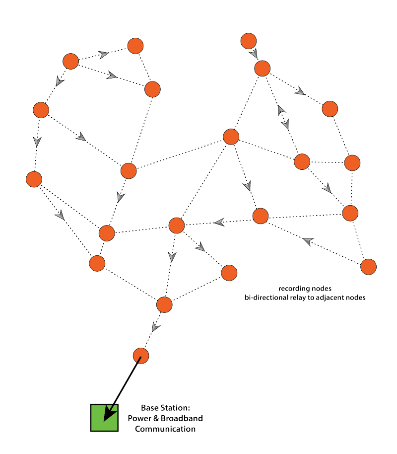
We are currently exploring ideas like scattering solar-powered mini-recording stations across the forest canopy and gathering the resulting data with a remotely operated airship cruising above, and something called a ‘mesh network’, whereby data are passed from node to node in a grid within the forest to a central location where power is available and the data can then be sent to where it is needed.


